Salem Aerial – The Overview

Drone image of a cluster evergreen trees

“Get a better perspective with Salem Aerial.” This is not just our slogan but also our mantra. When we take flight–no matter the location–we hope to provide our clients with the best possible view of their property.

I decided to detail some of the features to our services so that you can be as informed as possible.

DJI Inspire 1

  • 4K Video — We can choose to capture video in either HD or 4 x HD
  • 12 Megapixel Photos — Salem Aerial not only offers video but also still images taken by our 12MP camera!
  • Gimbal Stability — The DJI Inspire 1 camera is attached via a gimbal which minimizes the affects of the drone’s movement on the video/picture
  • 360⁰ Rotating Camera — The legs on the drone lift up during flight to allow the camera optimal mobility
  • Raw Capture — Images can be captured in multiple formats – including raw (DNG)!

Reasons | Locations | Ideas

You may be wondering – can Salem Aerial help me with this project? Your confusion stops here!

  • Events — Do you have a parade or other event that needs aerial footage? We do that!
  • Property — Have you wanted to see your home or business from the sky? No problem!
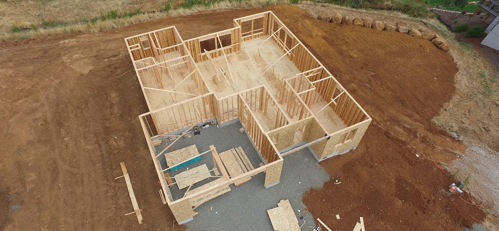
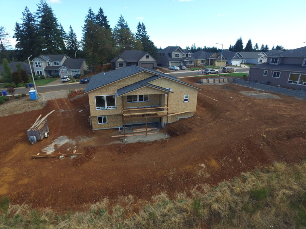
  • Construction — Perhaps you are in the midst of a build… Get a better perspective with us!
  • Flyovers — Are you a golf course or other business in need of a video flyover? Look no further!
  • Access — Can’t see something from the ground? We are here to be your eyes!

With our top of the line technology and down to earth customer service, why wait to call? Contact us today!

Phone: 503.602.9074
Email: jason@salemaerial.com

Aerial Drone Mapping

Image of drone mapping.
What can aerial drone mapping do for you? The easier question is what can’t it do! In doing research for this article, I ran across a wide variety of applications and enough information to make my head spin. I will try to break it down to the basics then more future articles with more detail.

Applications

  • Real Estate & Construction: Planning, Marketing, Progress
  • Nature Conservancy: Water Sheds, Preserves, Wetlands
  • Agriculture
  • Surveying
  • Inspections: Bridges, Roofs & Equipment, Infrastructure
  • Security Planning: View areas of shadow and plan for camera placement
  • Accident Reconstruction

Why Drones?

Unmanned Aerial Systems (UAS), are cost and fuel effective, easier on the environment, and require less overhead and administration than operating larger manned aircraft.

“Unmanned Aerial Systems (UAS), are cost and fuel effective, easier on the environment, and require less overhead and administration”

The Mission

Global Positioning System (GPS) waypoints are set prior to the mission and can be recalled and used for future missions, ensuring that the drone is capturing the same area every time. This is especially helpful when monitoring a construction site, nature area, water shed, or progress of an agricultural crop just to name a few.

The UAS camera is pointed straight down and the software used for mapping, will fly the mission on its’ own. Hundreds to thousands of photos will be taken.

Processing & Views

After the mission, the photos will be uploaded to one of numerous programs available for mapping. They will be “stitched” together to form a cohesive picture that can be viewed in a variety of ways. This is called an orthomosaic. There are cell phone apps that allow you to take this orthomosaic into the field so you can find the features you marked on the map during analysis. A couple of applications are locating and eliminating noxious weeds or marking property boundaries.

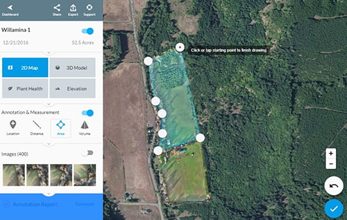
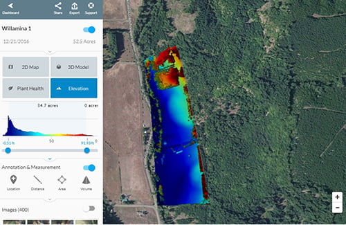
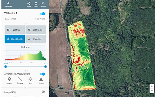
The software used by Salem Aerial, for example, allows you to view 2D, 3D, Plant Health, & Elevation.

Aerial drone mapping screenshot showing a preview of the 2s map specs

Drone Mapping Software

Basic Features

  • Measure distance and it will also show you the elevation as you move along the path you drew.
  • Select an area to find out the number of acres.
  • Select an area that includes width and height to find volume.
  • Perimeter Calculations.
  • Annotate all of these on the map and then generate a report showing your measurements.

Advanced Features

  • Point Cloud for 3D modeling, measuring, and triangulation
  • Contour Maps to show elevation
  • GIS (Geographic Information System) Layers – Showing different types of geographic or plant data in each layer
  • Agriculture:  Searching for a specific weed color to identify locations, for example.
  • And so much more!

Aerial drone mapping screenshot showing a preview of the elevation specs
Aerial drone mapping screenshot showing a preview of the planet health specs

The New “Thing” in Real Estate – Drone Photography

Aerial view of a new home
Real Estate is all about showing a home or property to its best advantage and agents regularly work an age-old plan. They re-arrange furniture so it looks attractive, adding decorations and flowers, play classical music, and have fresh baked cookies as potential buyers view the house. This is called “staging” and a necessary piece to selling a home.

However, in our current culture where schedules are tight and time is money, what about potential buyers who want to shop from the comfort of their home? How do you capture their interest? Aerial drones are fast becoming a necessary tool in the Real Estate world. With them you can produce high-quality videos and photos of your house and property, inside and out, to entice potential buyers and improve your reputation with potential sellers.

Drone videos are far more convenient than attending an open house, easily offering a 360-degree view that makes you feel as if you’re really there. Videos and photos provide a bird’s eye view of the property and a sense of scale. Aerial footage also gives buyers an idea of the surrounding neighborhood, what the driveway connecting to the street is like, as well as landscape and environment. Furthermore, they are less expensive than using a helicopter, plane, or crane to obtain this footage with a regular camera.

“Drone videos are far more convenient than attending an open house, easily offering a 360-degree view that makes you feel as if you’re really there.”

Drone videos and photos are effective, affordable, environmentally friendly, and a unique way to add a sales technique to your portfolio. Incorporating them into your marketing strategy will set you apart!

Aerial view of home construction
Aerial view of new home construction.